Romanian Agri-Tech startup OGOR helps farmers with satellite images analysis

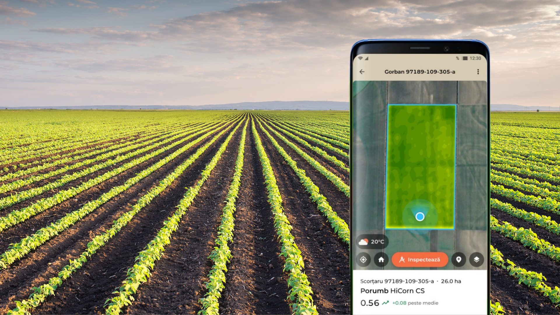
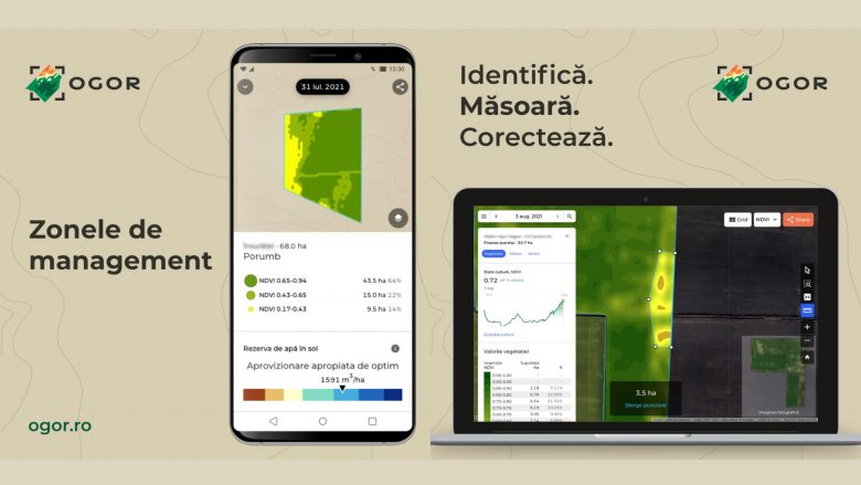
OGOR, which in Romanian means “land”, is a Romanian Agri-Tech startup that offers a smarter way to understand the evolution of the field. With the OGOR web and mobile application, farmers could easily track what impact different factors have on their fields and production. By collecting data from satellite images, the OGOR app enables farmers to identify precisely where the crop is most affected looking at components such as sowing date, harvest date, hybrid, and work performed.
FIND OUT MORE: Interview with Svetlana Boyanova, Institute for Agrostrategies and Innovation
The main goal of OGOR is to build and grow a sustainable business that contributes to the economic development of the European agricultural sector. The team behind the project is highly concerned with the impact of climate change and acknowledges the need to adapt the practices in the field to respond to the current environmental challenges. Founded in 2019 by five Romanian entrepreneurs, the startup has more than 49 regional trial farmers using their service, covering 88,000 hectares of agricultural fields.
“In 2019, we established Ogor starting from three things: a team of experienced programmers, passionate about processing satellite images, a successful entrepreneur who understood the development potential of Romanian agriculture and the essential role technology is to play in this development, and the high interest of many successful agronomists in Romania for our idea,” shares Dafina Jeacă, co-founder and COO of OGOR.
What does the OGOR application offer?
- Satellite NDVI*, NDWI** images, and management areas
- Tracking the evolution of crops during the season
- Tracking crop rotation history from 2017 up to date
- Tracking soil humidity reserve for wheat and corn
- Field inspection with GPS location
- Weather forecast for the next 7 days
What is a satellite image?
How does it work?
How accurate is the data?