Super El Niño Breaks Temperature Record, Months Before Its Peak


Set Trending Topics as a preferred source on Google.
The tropical Pacific has never been this hot since records began. Sea surface temperatures in the so-called Niño 3.4 region, the key monitoring zone for El Niño, recently climbed more than 3 degrees Celsius above the long-term average. That is what the daily data from the University of Maine’s Climate Reanalyzer shows, which processes satellite measurements from the U.S. National Oceanic and Atmospheric Administration (OISST). According to Science News, the anomaly reached 3.08 degrees above the 1991 to 2020 average, surpassing the previous record of 3.02 degrees set in November 2015. And the peak is still to come.
The Peak Arrives in Winter
What stands out most is the timing. El Niño normally reaches full strength between November and January. During the previous record events of 1997/98 and 2015/16, the anomaly stood at only about 1.9 degrees in early September, Carbon Brief calculates. Models expect the peak to average around 4.1 degrees, with four out of five of the 674 model runs analyzed landing between 3.4 and 4.6 degrees.
NOAA’s official outlook is equally clear. The Climate Prediction Center puts the chance of a “very strong” event this fall and winter at more than 90 percent, and gives a 75 percent chance that it becomes stronger than any El Niño since 1950. “We’re probably going to reach our peak within the next few months,” says Nathaniel Johnson of NOAA’s Geophysical Fluid Dynamics Laboratory. Nathan Lenssen of the National Center for Atmospheric Research links the extreme values partly to global warming: “Due to the warming of the planet, there is more energy in the oceans now.”
2027 Could Be the Hottest Year on Record
The consequences for global temperatures are significant. According to Carbon Brief, 2026 is likely to be the warmest or second warmest year on record. The full effect arrives with a delay, though, and the biggest impact is expected in 2027. Projections from the University of Chicago’s Climate Impact Lab show how severe the human toll could be: by February 2027, the super El Niño could cause around 451,000 additional heat deaths worldwide.
In the West: Hurricanes Fueled by a Superheated Pacific
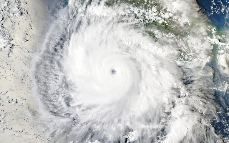
The effects are already visible along U.S. coasts, in very different ways. In the eastern Pacific, the warm water is fueling an unusually active hurricane season. Hurricane Polo recently became a Category 5 storm with winds of around 180 miles per hour (about 290 km/h). According to NOAA, it strengthened by roughly 110 miles per hour within 24 hours, the third fastest intensification ever recorded in the eastern Pacific after Patricia (2015) and Otis (2023). Polo is already the region’s third Category 5 storm of the season, following Genevieve and Lowell.
California felt the effects, too. The remnants of Hurricane Marie brought rare rain to Southern California in early September: Los Angeles International Airport recorded about 0.6 inches (15 millimeters), according to Fox Weather, nearly three times its usual total for the entire month.
In the East: A Quiet Atlantic, but an Early Nor’easter
On the other side of the continent, El Niño works the opposite way. Over the Atlantic, it strengthens upper-level wind shear, which keeps hurricanes from forming. NOAA therefore sees a 75 percent chance of a below-normal season. “When El Niño occurs, it usually becomes the dominant factor for the whole hurricane season, and this El Niño is getting stronger every month,” says NOAA hurricane expert Matt Rosencrans.
The East Coast did not stay calm, however. An unusually strong nor’easter for this time of year swept across the Northeast last weekend. It brought gusts of up to 80 miles per hour (about 130 km/h), coastal flooding from Long Island to the Outer Banks and, according to the A.P., left more than 130,000 households without power. In New York, one person was killed by a falling tree. Storms like this usually occur in late fall and winter. Whether El Niño played a role in this particular storm is hard to say.